
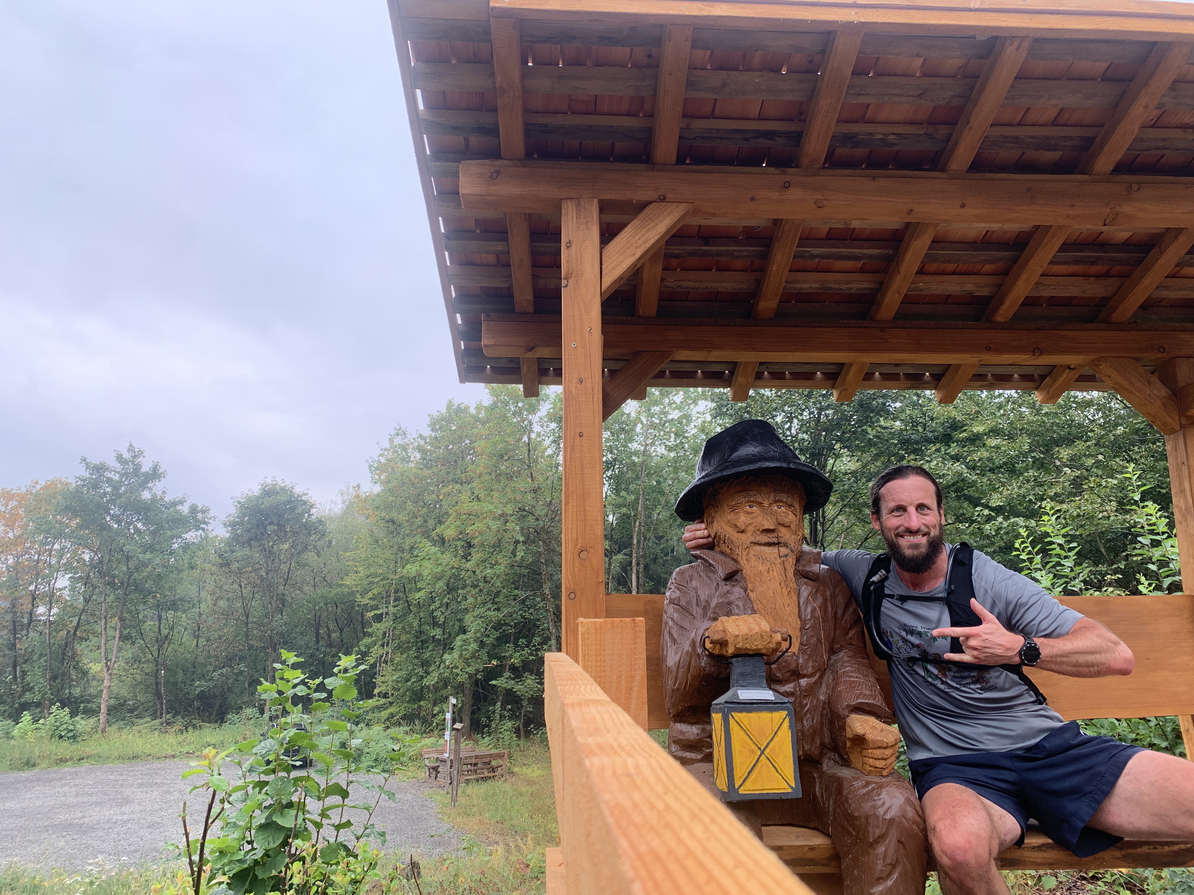
Who's Afraid of the Black Man? Thirty Kilometres Around a Mountain I Never Visited
Schnee-Eifel, Rhineland-Palatinate: a Monday run around the Schwarzer Mann.
"Wer hat Angst vorm Schwarzen Mann?" was one of our favourite chasing games in Kindergarten. You lined up on one side of the yard, someone growled the question from the middle, and then everybody ran. Nobody thought twice about the name. In the eighties it was simply what the game was called. Today it has quietly gone out of fashion; the game survives, the title less so, and the racist undertone it carries is finally being named for what it is.
So, there was something faintly time-travelling about driving out to visit my parents in the Schnee-Eifel and spending a Monday running circles around a mountain with exactly that name: Der Schwarze Mann.
Here is the part I only learned while writing this. The mountain is not named after the bogeyman of the playground at all. The name is said to come from the soot-blackened faces of the miners who dug lead ore in Bleialf and walked home over the ridge at the end of a shift. A working name, not a frightening one. Which is a small and useful lesson in itself: the story you carry about a place from childhood and the story the place actually has are rarely the same one.
The other thing worth knowing is that the summit isn't quite the summit. The Schwarzer Mann tops out at around 697 metres, and the highest point of the whole Schneifel (that’s what the local call the area) ridge is a marked stone - the Tranchotstein, named after one of Napoleon's geographers - sitting at 700.9 metres, a few hundred metres to the south-west. So, the mountain everyone comes for is not the highest point, and the highest point is a boundary stone almost nobody photographs.
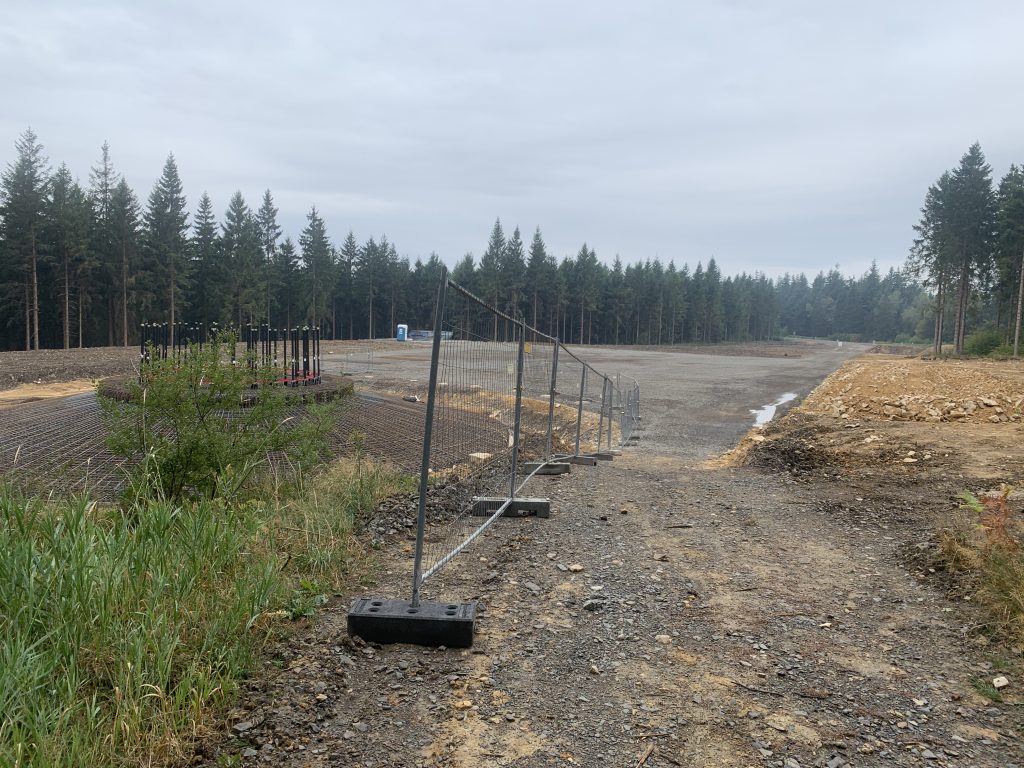
I very nearly didn't either. There was major construction work going on up top when I came through, which made finding the right line genuinely awkward. Fenced-off sections, churned ground, and the path doing the sort of vanishing act that has you standing still and squinting at a map. I stumbled across the stone more or less by accident. Which is, again, very Eifel.
The hill next door
What struck me most, running it, was how long it took me to get here at all.
I went to secondary school in Prüm, grades five to ten, more or less at the foot of this thing and we never went up. Not once with the school. Not with my parents either. Nobody seemed to think it merited the trip.
From my parents' point of view that made complete sense. I was out of the house from morning to dark anyway, in fields and forests and other people's gardens, so why drive somewhere further afield to look at more trees? The nearby is invisible when you are already living in it. I've written before about the loops I couldn't leave and the places that quietly shape how you run; this was the inverse. The place right there that never became a place at all, because it was never framed as a destination.
What the ridge was actually doing
Which is a shame, because the ridge is thick with history.
The whole length of the Schneifel is covered in the concrete ruins of the Westwall - the Siegfried Line - built between 1938 and 1940. During the autumn and winter of 1944/45, this sector and the nearby Hürtgen Forest saw some of the most brutal and costly fighting on the Western Front. On 16 December 1944 the German army launched the offensive that became the Battle of the Bulge, and the dense forests of the Schnee-Eifel, with Prüm as a logistical hub, served as staging ground and jump-off point for the surprise assault. You run past bunker stumps in the moss without any signage telling you what you've just passed.
It only clicked afterwards that I had also gone through Hontheim, a district of Sellerich on the south-eastern slope of the ridge and that this is where the Reichsarbeitsdienstlager stood, north of the village, from 1933 until 1945. From 1935 onwards, young men had to complete compulsory labour service there before being called up, and remains of the camp gate are still catalogued among the region's cultural heritage. Local Westwall researchers place its expansion around 1937, in step with the fortification work.
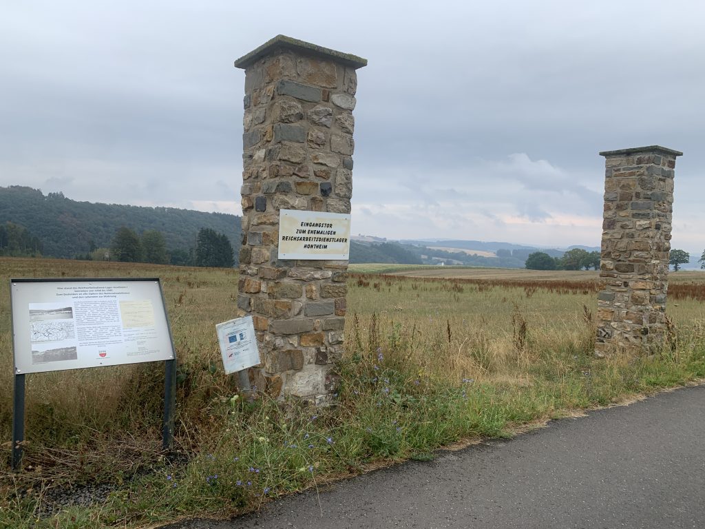
Which answers the question the bunkers don't. The concrete didn't arrive on its own. It was poured by people who lived a few kilometres down the slope, a good number of them barely out of school, roughly the age I was when I attended school in Prüm and considered this whole ridge not worth the trip. That thought arrived somewhere around kilometre twelve, not far from where I'd hidden my water bottle, and it sat with me for a while.
My own first deliberate trip up here came much later, and for far more mundane reasons: 1997, during my apprenticeship with Deutsche Telekom, servicing Prüm Air Station. A Cold War US radar and communications installation built in the 1950s, home to around a thousand American soldiers at its peak, watching the airspace and handling strategic military traffic until it closed in 2004. Cable, racks, coffee. That was, honestly, the sum total of my relationship with the Schwarzer Mann until this run.
What the weekend was actually for
The run wasn't the reason I drove out. My parents are in their seventies now, and I keep up a stubborn one-man campaign to stop their technology quietly dying on them. This time it was the family computer: fifteen-year-old Dell Inspiron, slower every visit, the sort of machine most people would have taken to the recycling yard years ago. It got an SSD and a Linux install, and now it has another life in it.
They don't care whether it says Windows or Linux on the box. They care that it opens, that it's quick, and that the buttons are where they were yesterday. Fair enough. It's a good reminder that "past its prime" and "finished" are not the same condition, which turned out to be the running theme of the whole weekend, as it happens.
Thirty kilometres, no aid station
The route took me around the peak and down through the foothills, roughly 30k, which currently sits in the useful middle of my build towards a hundred.
Somewhere in the second third I came out at the Wolfsschlucht ski slope and had a genuine jolt of recognition. I boarded down that once or twice in my teenage years. It, too, is in slow decline. There is barely any snowfall left to speak of, and a Rhineland-Palatinate "winter sports area" without winter is a hard business case.
Supplies out there are thin. The restaurant at the top opens Thursday to Sunday; I ran on a Monday. So, a bit of improvisation was needed:
- Graveyards. The ultrarunner's last resort. Tap, watering can, always water.
- The stash. I left a bottle in the bushes on the outbound leg with a Post-it note on it, in the hope that a passing Eifeler would read it as "belongs to an idiot in shorts" rather than as litter. It worked.
- The doorbell. Ring somewhere, ask nicely for tap water. You may or may not get served. Speak Eifeler Platt and your odds improve considerably.
Smoke on the ridge
The self-built aid station wasn't the only complication. A forest fire was still burning at the Hohes Venn, right on the Belgian border. Another area I know far too well, having run a gym in Bütgenbach, where a few hundred people had to be evacuated.
Wildfires are not news in this region. Fires of that size are. The heat of the past weeks is taking a toll on people, but just as much on wildlife and on the landscape itself. The smoke drifted over the whole Eifel, and for a while on Sunday evening I genuinely wasn't sure I would be running at all. Then rain came through on Monday morning, washed the air a little cleaner, and, I hope, gave the women and men fighting the blaze something to work with.
So, there I sat afterwards, next to the Schwarzer Mann, grinning about my Post-it note and my graveyard tap, while a few dozen kilometres away other people were afraid for their livelihoods. Both things were true at the same time, and running doesn't resolve that; it just puts you in the landscape where you can't avoid noticing it.
May the damage stay small and the recovery be swift: physically, and psychologically too.
Route notes
Where: Schwarzer Mann, Schneifel ridge, north-west of Prüm, Eifelkreis Bitburg-Prüm. Close to the Belgian border, inside the Hohes Venn–Eifel nature park.
Distance: ~30 km, loop around the peak and through the foothills.
Terrain: Forest track and ridge path, Ems quartzite underfoot, gentle by trail standards but relentlessly rolling.
Water: Plan it. Restaurant at the top opens Thursday–Sunday. Hide it, graveyards, or doorbells otherwise.
Worth a detour: The Tranchotstein at 700.9 m; the actual high point of the Schneifel and the Westwall bunker ruins scattered the length of the ridge.
Heads up: Construction near the top at the time of writing. Navigation around the summit area is fiddlier than the map suggests; don't rely on following your nose.
GPX: Download the route >>here
Strava: Zero segments in 30 km. One small step for a runner, one entirely unremarkable loop for mankind.